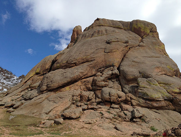
Right by the side of the road in the south of the national park is this rocky outcrop that you can scramble up to squeeze within its cavernous space. It’s where 100 lamas hid in an attempt to escape the communist purge in the 1930s. Tragically, however, they were found and executed.
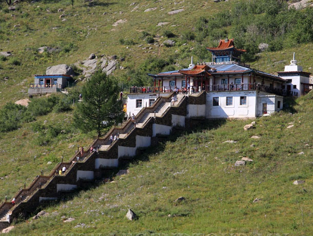
The Aryabal temple, which is 60 km away from UB.
Aryabal meditation temple was built in 1810-s by Mongolian and Tibetan artists in Terelj National Park. In many cases Buddhist monks from Manzushir monastery came to this temple to make meditation. The temple style is more Tibetan styled like white square shaoed and white colored main building and porcelain roofs decorated with Buddhist and religious signs. In 1937-1939 Mongolian communists came to this temple and destroyed it completely and killed some monks from this temple.
Location: 10 km to the south from Ulaanbaatar.
Features: In 1778 the Mongolian government made Bogd Khan Uul a national park to protect its beauty making Bogd Khan Uul the oldest national park in the world. Its highest point is 2268 m above sea level. Bogd Khan Uul was added to the UNESCO World Heritage Tentative List on August 6, 1996 in the Cultural category. World Heritage sites are those that exhibit universal natural or cultural significance or both.
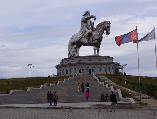
By far Mongolia’s most recognizable landmark and one of the world’s largest equestrian statues, the 131-foot-tall (40-meter-tall) Genghis Khan Statue Complex (Chinggis Khaan Statue Complex) towers over the surrounding landscape. Ride the elevator up inside the horse, learn about the Mongols at the museum, shop for souvenirs, or enjoy a snack at the café.
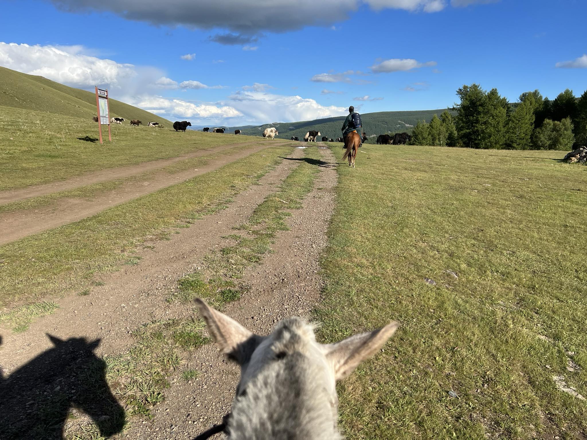
The small village of Gachuurt is 20 kilometres East Ulan-Bator, at the edge of the Gorkhi-Terelj National Park and of the strictly protected area of Khan Khentii. It stretches on the banks of the Tuul River, invaded by many picknickers in summer. The village offers a peaceful atmosphere, a good environment for field sports like biking, hiking, horse riding. It’s a booming suburb very popular for rich Mongolians ; they build houses on the highest hills.
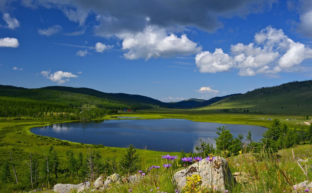
Khagiin Khar Lake-location of the lake is relatively close, just 110 km from Terelj National Park and 180 km from Ulaanbaatar. The 2.5 km by 1 km lake lies at 1817 m above the sea level, surrounded by coniferous forests. An average depth of the lake is 11 m while it reaches 25 m at its deepest. Reflection of the surrounding coniferous tree-covered mountains in the lake water makes the lake more beautiful. As the lake is only accessible by foot, horse or helicopter, the way to the lake and its surrounding remained pristine. Therefore, the lake is called “Secret beauty.” Its inaccessibility allows the wild animals such as red deer, elk, roebuck, musk deer, brown bear, wolf, lynx, and wolverine have left peacefully in the wild without danger of people.
Kharkhorin – In 1220 Chinggis Khaan established the capital of Mongolian empire on the fertile plains along the Orkhon River. This is called Kharkhorin, 373 km from Ulaanbaatar city. Kharkhorin is located at the lower end of the upper valley of the Orkhon River, which is part if the World Heritage Site Orkhon Valley Cultural Landscape. The location marks the eastern foothills of the Khangai Mountains.
Erdene Zuu – The first Buddhist monastery called Erdene-Zuu was built on ruins of Kharkhorin. It was built in 1586 at the initiative of Avtai khan, most influential Prince of that time in Mongolia The monastery occupies an area surrounded by a stone wall with 108 stupas lining on it. The Erdene-Zuu monastery preserves marvelous works of Mongolian artists, painters, cutters, sculptors, embroiders and craftsman of the XVII-XIX centuries.
In 1954-1958, the Nalaikh mine was constructed basing on the large mines. It is located 36 km southeast of the capital city. There are many historical and cultural sites in our Nalaikh area: the Chinggis Khaan’s and Turk Tonyukuk’s statue, the Khan Khentiast National Park, and the Gorkhi-Terelj National Park. There is a place called “Chinggis Khuree” in the foot of the Chinggis mountain between Khukh Termis and Tuul river.

It is especially impressive due to its strangely shaped rock formations. Two famous formations have been named after the things that they resemble: Turtle Rock and the Old Man Reading a Book (Praying Lama Rock). Terelj also offers great opportunities for walking, hiking, rock climbing, swimming (in icy cold water), rafting, horse riding and, for hardcore extreme sports fanatics, skiing in the depths of winter. There is also a Buddhist monastery that is open to public.
Gorkhi-Terelj National Park is located in the northern central part of of Mongolia not far from the border. The national park covers an area of 1,127 square miles (2,920 sq km). Although it extends across such a large area, it is only the 14th largest national park in Mongolia. The Terelj River flows across the park, which much of the protected zone located to the north of the river. The Terelj settlement is located along the river and this region provides visitors with opportunities to shop and dine. This tourist area also provides opportunities to rent horses or camels for doing a more adventure exploration of the area.
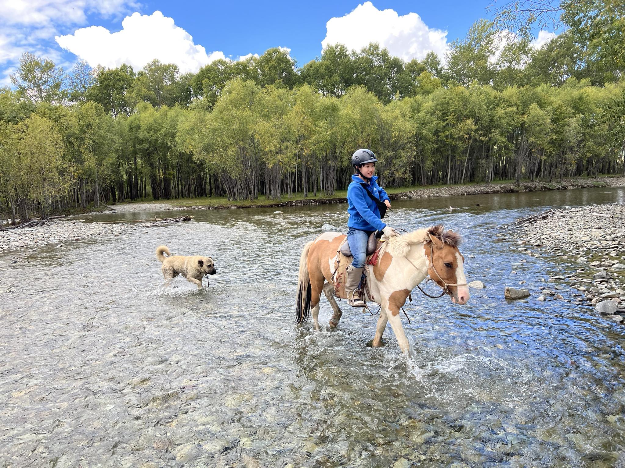
There are numerous ger camps and resorts in the tourist zone before the Terelj River. The rest of the protection zones start after the Terelj River and become less touristy, less inhabited with pristine nature. The depths of the mountain forest are rich in wild animals, including boar, red deer, roe deer, fox, wolves, etc while birds of prey fly everywhere. Except for the natural beauty, Terelj was a mining area of smokestone, amethyst, and pure crystal till 1960.
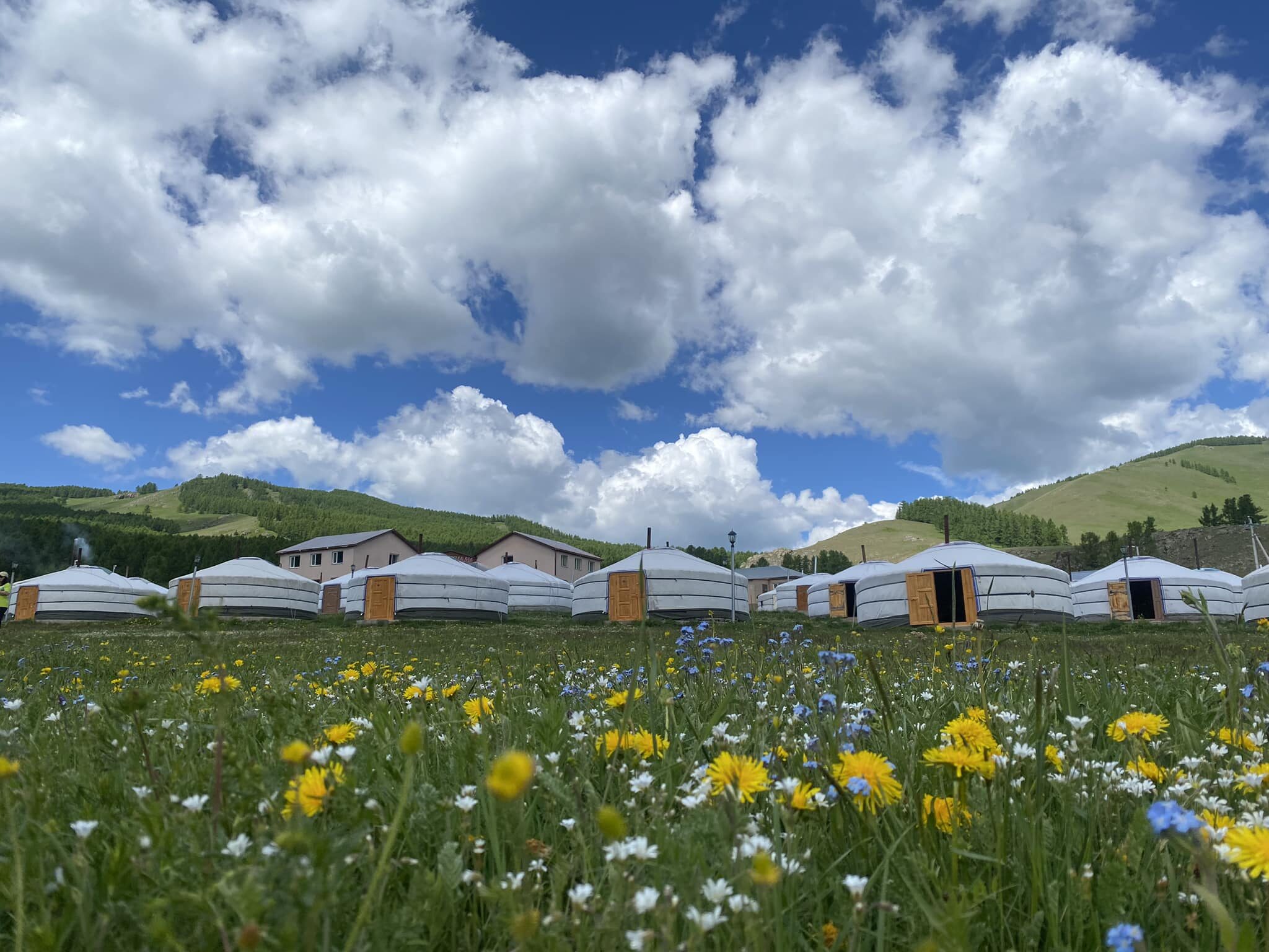
Welcome to the resort “TUMENKHAAN” located at km 70 from Ulaanbaatar in the area of Terelj National Park. It takes only one and half hour (1.5 hours) to reach the resort.Our resort is located in a peaceful place with unique attractions. It is surrounded by Khentii Mountains with beautiful forests that consist of cold spring, various kinds of birds and medicinal herbs. Therefore, the tourists prefer to visit and relax in our resort. If you choose our resort you will enjoy sightseeing, visiting herders’ family and learning Mongolian nomadic lifestyle and tradition. Moreover, there is a good opportunity for horse riding trip. Our resort is not so far away from Ulaanbaatar as we mentioned above so you can organize day and short trip. Commuting service is offered for your arrival and departure time from Ulaanbaatar city, the airport “Chinggis Khaan”, hotels, guest houses, ger camps, the train station “Ulaanbaatar” and a bus stop. In addition, it is available to arrange many kinds of events such as anniversary and meetings in our resort. Our company has been provided with communication system and electricity fully.
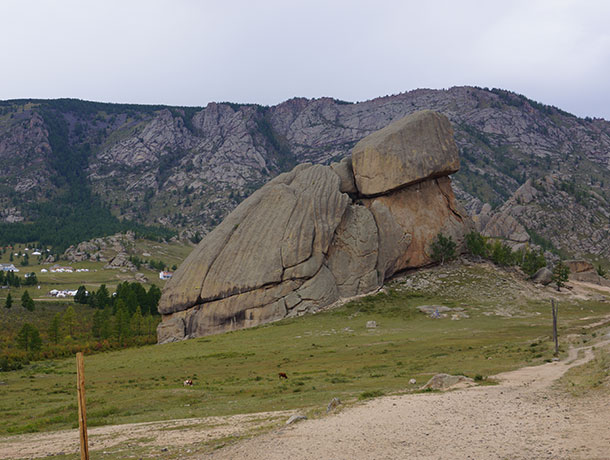
Turtle Rock, ”Melkhii Khad”, is a surprising granitic formation, 24 metres (79 feet) high, whose form reminds of a turtle. Located at the foothills of a mountain covered of pines, this rocky formation is incontestably a photo opportunity while you’re on the road for Terelj. There, it’s possible to rent horses, and during the summer, you can also find souvenirs’ sellers. It’s a good starting point for a small walk (about one hour) that will lead you until the centre of meditation of Aryaval or in the most remote places of the park.
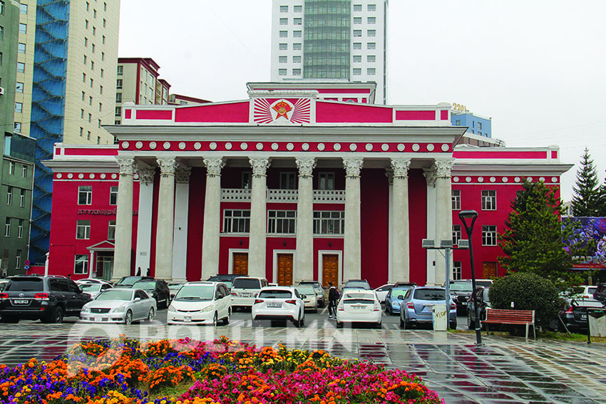
Ulaan is red and Baatar is hero in Mongolian. In general, Ulaanbaatar means “red hero” and it was renamed when Mongolians declared a people’s republic a hundred years ago. There are 1.4 million people live in the city and it is considered as a modern city. The city had moved twenty five times between 17th to 19th centuries to many places along the Orkhon, Selenge and Tuul rivers. Ulaanbaatar was built at its present location and called the City of Felt. Later, the city became the foundation of the former Urguu, present Ulaanbaatar. The former names of Ulaanbaatar were Urguu (1639-1778), Ikh Khuree (1778-1910) and Niislel Khuree (1911-1921).